Thursday, July 2, 2009

Colorado Springs - Mesa Verde


...is pretty much just a westward trek through the Rockies in southern Colorado. Now, before you hardcore Rockies enthusiasts come at me for that last statement, mind you: we were just passing through at this point on our way to Mesa Verde National Park. If it were up to me, I would have checked out the Tepee Buttes, Spanish peaks, anything and everything between Colorado City and Durango - but it wasn't up to me.

BUT - we stopped by Great Sand Dunes National Park.

I enjoyed Sand Dunes. We actually skipped a stop further in towards Silverton, Colorado, a town built within an ancient caldera to go there. Now, we ended up skipping a few spots on this trip, and I don't know who's to blame for this, so I'll let it go. But please, never tell a group of geologist that they're going to a caldera - and not do it.

On to Sand Dunes. Sadly, we did not spend an ample amount of time here either, but what we did see was what gets geomorphologists like myself to sleep at night.

The first photo on the top of the page, is being described in the lecture of the century by Dr. Albanese here (heavy, dark minerals [magnetite] are being deposited in the shallow stream, due to their higher density, they form bars). I figured that this was about as good as a geology lecture photo gets, so here it is:

What are, I believe, some SUCO field trip goers:
Some serious cumulnimbi forming north of the Dunes:
Wishing to grow up to be just like the Navajo Sandstone:

And later that day...

We also drove over the continental divide, did some nalgene experiments (to no avail) and had a beautiful overlook of the San Juan National Forest later on. At this point, though, we had driven into more storms associated with the thunderheads in picture #4, so photography increased in difficulty.

The Continental Divide (someone put a sign in front of it...):

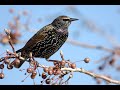
A good looking jay at the San Juan N.F. overlook...you might even say, Stellar:

And one amazing view of the SJNF:

Tuesday, June 30, 2009

Garden of the Gods: Mainly a Picture Show

(Still) Day 4 - Garden of the Gods, Colorado Springs, Colorado

After our morning of tempting gravity to pull our 2-ton vans down 5000' of Pike's Peak Granite, we venture on to western Colorado Springs to unwind with cold nalgenes and soft rock. Colorado BASIN soft rock (ohhh geology joke....) Anyways, we arrive at Garden of the Gods around 1PM, after eating lunch in the scalding visitor's center parking lot, and after visiting the welcoming center. (Beware: this is not the first time we'll stop by a visitor's center before actually visiting the attraction.)

The Garen of the Gods stop is a series of tremendous, near vertical or completely vertical tipping bedrock monoliths protruding upwards. Aside from one bright white limestone piece, many orange and deep pinkish-tan sandstone outcrops (with outrageous sedimentary structures) surround you as you enter the park. I believe the rocks are Paleozoic, but my rite-in-the-rain notebook is currently drying in the dining room right now. Anyways, on to more pitcures.

Les Hasbargen in Super-Geologist-Photo Mode
Vertical Bedrock=Drool
Sedimentary Structures worth Killing For
Something happened riiiiiight here...
Don't tell my geo-colleagues I took pictures of a dicot...I mean plant..
And this.


Monday, June 29, 2009

Pikes Peak (or) I'm Going to Die, Volume 1

Day 4
Pikes Peak, Colorado

So we got up pretty early to take a ride up to Pikes Peak. Thinking that it would be a typical up-mountain tredge in our beastly Chevy 3500 Vans, and obviously tainted by my assumption that this meager 14,000' peak would be just like negotiating Whiteface Mountain (4600') of the Adirondacks.

I was wrong.

The ride up was devastating. Switchbacks all the way up, for about 14 miles I believe, all with near-vertical cliffs at every hairpin turn. Not to mention, coming around every corner there seemed to be rock outcroppings just high enough to obscure the view from the vans. Also, it doesn't help when your driver is a rubber-necking geology professor more interested in the surrounding mountains than his own well-being.

Our first stop was at a visitor's center about 30% up the mountain by a nice body of water known as Crystal Creek Reservoir.


A little later we stopped once again, a stop which was probably induced by personal comfort issues (gasses expand at higher altitudes, including the ones inside you) at Glen Cove. From here you can see a heavily jointed rock face, as to be expected in this part of the country, but also, what seems suspiciously like a rock glacier...


To see the magical rock glacier, look in between the trees in the center of the photograph. I have not found any published information on rock glaciers at Pikes Peak, but it's still kind of a new field. This looks quite a bit like those developed in the highlands of Maine which remain active in movement during the summer months when temperatures can fall below freezing.

Moving on. On to the Peak itself! From here you'll see a few typecast tourist-rockhound photos. But they're still rad, so check them out.


Looking out over Colorado Springs vicinity.


Some much tougher grasses than myself...


A hungry fox...


Rockhounding some Pike's Peak Granite


Scientists at play...


...and water and rocks, at the same time...

Coming up next: Day 4 Part 2 - Garden of the Gods

Sunday, June 28, 2009

Getting it Started Again

So it's been about two weeks since we returned from the Western trip, and I figure it's about time to start posting again. I plan on doing a day-by-day kind of this, but for the sake of boredom I will sum up the first three travel days into one post, rather than three.

Day 1 - Oneonta-Enon Beach, Ohio

Upon arriving at our (meth lab) campsite in Enon beach, Ohio, camp spirits are high. Everyone is getting to know each other, though the vans were semi-segregated so far (geology in one van, bio-ecology in the other, including professors.) We decided to time our tent-setting-up, but gave up after 10 minutes (we got better after this one day, we just forgot how to be decent human beings for one day).

Like I said, camp spirits are high, at least until dinner shows up...

TUNA SURPRISE!

Meanwhile, Ross, Brenden and Ryan are out getting a 30 rack of Miller High Life...

SPIRITS RETURN TO HIGH!

And Ducks:


Day 2 - Enon Beach, Ohio - Clinton Lake, Kansas

Definitely an improvement on the previous campsite. The drive was truly awful, sitting 3-a-seat from 7am-4pm, but camp spirits remain in good form, and the campsite is actually really nice. There is a reservoir nearby, and the pseudo-sunset offered some good dusk photography. Not much else to report, however, so here's some more pictures yayyy...


A common Bluet...though not blue at all:


A nice dusk shot of a bass condominium:


Day 3 - Clinton Lake, Kansas - Colorado Springs, Obvious (Getting Close!)

The excitement grows as we enter the Great(er) Plains of North America and venture into the territory of Pronghorn and Mule Deer. It's a welcome sight fore sore eyes of plains cottonwood leaves and a few insects.

Once we arrive in the greater Colorado Springs area, everything changes. Mountains rise up again, and us New Yorkers find solace in the fact there there's still snow atop Pike's Peak (just kidding..,or am I.) Also, it's taco night, and I'm cooking!


Next Up: Pike's Peak, Garden of the Gods

Sunday, May 24, 2009

Places to Be


Water n Rocks will be on hiatus for about three weeks as the authors will be taking a trip to the Southern Rocky Mountains.

Here's the itinerary:

May
25 - Depart Oneonta at 7 AM, Camping in Ohio
26 - Travel Day, camping in Kansas (or Nebraska)
27 - Arrive and Camp in Colorado Springs, CO at Chatfield State Park
28 - Pike's Peak, Garden of the Gods, Chatfield St. Pk.
29 - Petrified Forest, Morefield, Arizona
30 - Mesa Verde Nat'l Park, Balcony House, Morefield Arizona
31 - Silverton, CO, Camp at Morefield, Arizona

June
1 - Grand Canyon - Mather Campground
2 - Grand Canyon, West Rim - Mather Campground
3 - Grand Canyon, Cedar Ridge - Mather Campground
4 - Grand Canyon, East Rim - Mather Campground
5 - Travel Day, Zion National Park
6 - Hiking in Zion
7 - Arches National Park, Moab, Utah
8 - Arches National Park, Moab, Utah
9 - Mt. Evans, CO, Chatfield St. Pk.
10 - Rocky Mountain Nat'l Park, CO, Chatfield St. Pk.
11 - Arsenal Wilfdlife Refuge, Dinosaur Ridge, Red Rocks, Chatfiels St. Pk.
12 - Ogallala Aquifer, Nebraska
13 - Travel, Iowa
14 - Travel, Ohio
15 - Return to Oneonta, NY

Wednesday, May 20, 2009

The Water and Rocks...At The Same Time Phenotype

Today I headed up to Salmon River Falls in the Orwell(ish) area of Oswego County, New York. The falls had been an important fishing location for local Iroqouis natives before the settlement of the white men in central New York. Although, you wouldn't know it up in this area - there's hardly anyone here.

Recently the NY DEC has thrown some cash at the Salmon River Falls, and since it is situated on state land, they have built small trails and wooden stairs down to the top of the falls themsleves.

The falls are etched into 440+ MYA sandstones (that's Ordivician for non-geologers) and rise over 100' above the lower riverbed. The beds are mostly planar, with many ripple marks on the top layers, which are heavily jointed.

I appologise for the brief geology session, but this was more of a reconaissance mission than an in-depth study. However, if you're curious as to the formation of the falls - so am I. The river system, not a very powerful one, cuts deep into the sandstone without much explanation. My guess is that this was formed subglacially, mainly due to my previous studies on tunnel valleys along with the presence of striations and potholes, but I've truly never seen anything produce a channel quite like this one.

Now for pictures!
With my girl Lily atop the Falls.

The Salmon River leading towards the Falls.
Some glacially "punk'd" asymmetrical ripples.

The Falls themselves.
...And cliffs on the northside of the channel.

Monday, May 18, 2009

5-17 Circumzenithal Arc

Always look at the sky.

If you're ever searching for something to catch your interest, or something rare to shoot, always know that the sky is always worth taking a glance at. In the middle of a "graduation" party just yesterday, I decided to take a glance at the sky, around 3:45 PM Eastern. What I saw was this:

The sky has been my best friend these past months where it has been hard trying to get out into the woods and explore. This is the second arc I've seen in the skies above my house in the past year - the first being on a completely clear day in June of last summer.

So my advise to everyone boils down to one thing: If you can't see anything in front of you, look up.

Update: I decided to add a few more shots to the post. Enjoy.

This on kind of offers a matchstick ignition illusion to the red pine tree without a top in the lower right.

Peaking out from behind clouds.

Thursday, May 14, 2009

We'll be back Eventually

Things have been pretty hectic lately, and I haven't been able to make any posts. I'll hopefully get out and take some pictures tomorrow, but won't have internet access for a while.

...So here's a map of college camp!

Sunday, May 10, 2009

Epinephelus itajara


From time to time, I'm going to drop a rare species on our readers here at Water-n-Rocks. Today's installment comes to my attentions from History Channel's Monster Quest.

The Goliath Grouper

A cousin of one of North America's most popular game fish, the Goliath Grouper is a critically endangered monster fish lurking in the waters around Florida. It is common on the shore-continental shelf near Jupiter and other popular fishing destinations. They can grow to an impressive length of 8' at a weight of 800 lbs and have been known to attack divers.

Friday, May 8, 2009

Check it Out

So in my neverending thirst for sever weather, I stumbled across a huge cell brewing over Missouri this morning (after I aced the Geography of Developing Regions final). My roommate then mentioned they have live feeds from Discovery Channel's Storm Chasers, so I went to their website, and found that it is probably 100x better than The Weather Channel could ever hope to be.

For some reason, I cannot take screenshots right now, so you'll have to check it out yourself.

Tuesday, May 5, 2009

Cape Elizabeth

"The best geologist is the one who has seen the most rocks." - Dr.
Albanese


A month or so ago, our Geology Club ventured to Maine for the Northeastern Geological Society of America Conference. We took a day and went to Cape Elizabeth. The metamorphic features present were absolutely wicked.


Soil Nails

Pretty interesting story out of America's west coast here. The Colorado-based company, Landslide Solution Inc., has created this tremendous air compressor\nail gun to drive "nails" into unstable hillsides, effectively creating a block of soil on the hillslope, rather than building an unstable retaining wall or letting nature takes it course. Heads up to Dave's Landslide Blog for this one.

See the video.

Saturday, May 2, 2009

Fun Fact


Had to share this with everyone. It's an old paper, and I'm no professional ecologist, but Mackie, et. al. 1989 has this to say:

"Crayfish could have a significant impact on the densities of 1 to 5 mm long zebra mussels. An adult crayfish consumes an average of nearly 105 zebra mussels every day, or about 6000 mussels in a season."

Just a thought, NYSDEC.


Into the Woods - 5-1-09

So the department picnic came along at it's expected time this Friday, and seeing as I choose not to bring the Jeep down to college, I decided, along with Aucoin, to hike our way up to College Camp and back, hoping (yes, hoping) to run ourselves into a refreshing rain shower or too. On the way up, while the weather remained warm enough to break a clean sweat, we stayed dry and took our fair share of photographs, practicing for the western trip coming up in...25 days or so.


Well it's about time, this one took me about 20 minutes to center in the page, but we're good now. This shot is with the macro lens at leaf layer level. I tried to get a nice near-and-far images, and it seems to have worked out well for my meager Samsung Point-and-Shoot.

Here's a nice backlit macro shot of some very plentiful tree flowers along the way, I'll look up the species soon and edit the post with the info.

Glamour shot.


One of the ones I like the best out of the day, we got lucky enough to get some great lighting through the red pine plantation right near the camp.


Another good one here, at the same location as the birch picture from above. In this case it was just a typical point-and-shoot shot for Panaramio in GoogleEarth of the Red Trail

Friday, May 1, 2009

Lesson and Photo of the Day

Mmm. Floods. I don't know what it is about them, but I love floods. We become so accustomed to seeing water in certain places, and when said water breaches it's banks it creates, to me anyways, a whole new world.

Floods like the one we see in the picture are generally "absorbed" by riparian zone ecosystems which are generally recognized as the wooded borders of perennial streams. Riparian zones accept some excess sediment load from streams, absorb nutrients such as phosphorus and nitrogen (instead of depositing them in estuarine environments and creating hypoxic environments) and create beautiful woodland habitat.

This particular flood occurred in Spring 2009, in Blossvale, NY. Spring meltwater from the Tug Hill Plateau (which received over 9' of snow in some places) rapidly makes it's way downstream to Oneida Lake (after being intercepted by the NYS Barge Canal).